Google Maps has received an update on both Android and iOS, enabling users to see the containment zones demarcated in gray in Mumbai. The company worked closely with Brihanmumbai Municipal Corporation (BMC) to source the information. This is the latest feature addition to help out users in these trying times. “As people and businesses emerge from the lockdown, access to clear information about COVID-19 containment zones as recommended by the authorities in Mumbai will enable users to make better decisions as they move around the city,” stated a Google spokesperson (via Gadgets 360) in response to the feature launch.
COVID-19 Containtment Zones in Mumbai
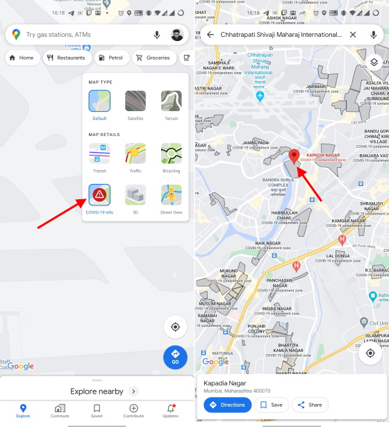
If you want to see the containment zones around your location in Mumbai, open the Google Maps app and tap on the ‘layers’ button near the top right. Here, you will find a new ‘COVID-19 info’ layer with a red danger icon.
Select the COVID-19 layer to see a color-coded map, which signifies the number of new COVID-19 cases (over a seven-day average) per 1 lakh users. Now, if you zoom out and there’s a containment zone near your location then it will be demarcated in a dark gray color. You can tap on the containment zones to see its name and location. Note: You will need to be running the latest Google Maps update, version 10.51.1 on Android and version 5.54 on iOS to access this feature. This feature is currently available to Mumbai residents but Google aims to expand it to more cities across India. It is working with the central and multiple state governments to display the most accurate (and up-to-date) data to users via Google Maps.